Company specialised in app development, professional websites, GIS systems and precision surveying. We transform ideas into real digital solutions.
From mobile apps and websites to GIS systems and precision surveying. Technology applied to real results.
Architecture and implementation of GIS. Spatial databases (PostGIS), GeoServer, advanced analysis, OGC services and custom plugin development for QGIS, ArcMap and ArcGIS Pro.
Cartographic viewers for real estate portals in the style of Idealista. Geographic search by area, price and type filters and georeferenced market analysis.
Multi-criteria analysis to find the ideal location for your business: population density, access to main roads, competition, foot traffic, purchasing power by area and proximity to services. Data-driven decisions, not intuition.
Custom web and mobile applications, interactive cartographic viewers, dashboards and professional portals for any sector.
Cadastral management, parcel delimitation, cadastre-registry coordination and boundary expert reports.
Slope analysis, pipe and valve sizing, cost optimisation and integral irrigation infrastructure planning. Hydraulic simulations with EPANET, GISPIPE and SWMM.
Technical and thematic mapping, infrastructure inventories and normalisation per INSPIRE and ISO 19115.
ETL pipelines and automatic processing with PyQGIS, GeoPandas, GDAL/OGR and Shapely. Reproducible workflows.
Processing, cleaning and publishing geographic data. WMS, WFS, WCS, WMTS and API Features services.
GPS/GNSS surveys, total station, set-outs, levelling and technical support for civil engineering projects.
Custom desktop applications and business software: time-tracking and attendance systems, invoicing and quotes, stock and inventory control, CRM and management dashboards. We automate internal processes and connect your tools so you work with less effort.
Optimal route calculation for transport, delivery and logistics companies. Route optimisation based on distance, time, time windows and vehicle capacity (VRP), reducing mileage, fuel and delivery times. Road network analysis with GIS and fleet planning to deliver more with fewer resources.
From mobile apps to geospatial analysis: real projects with direct, measurable results.
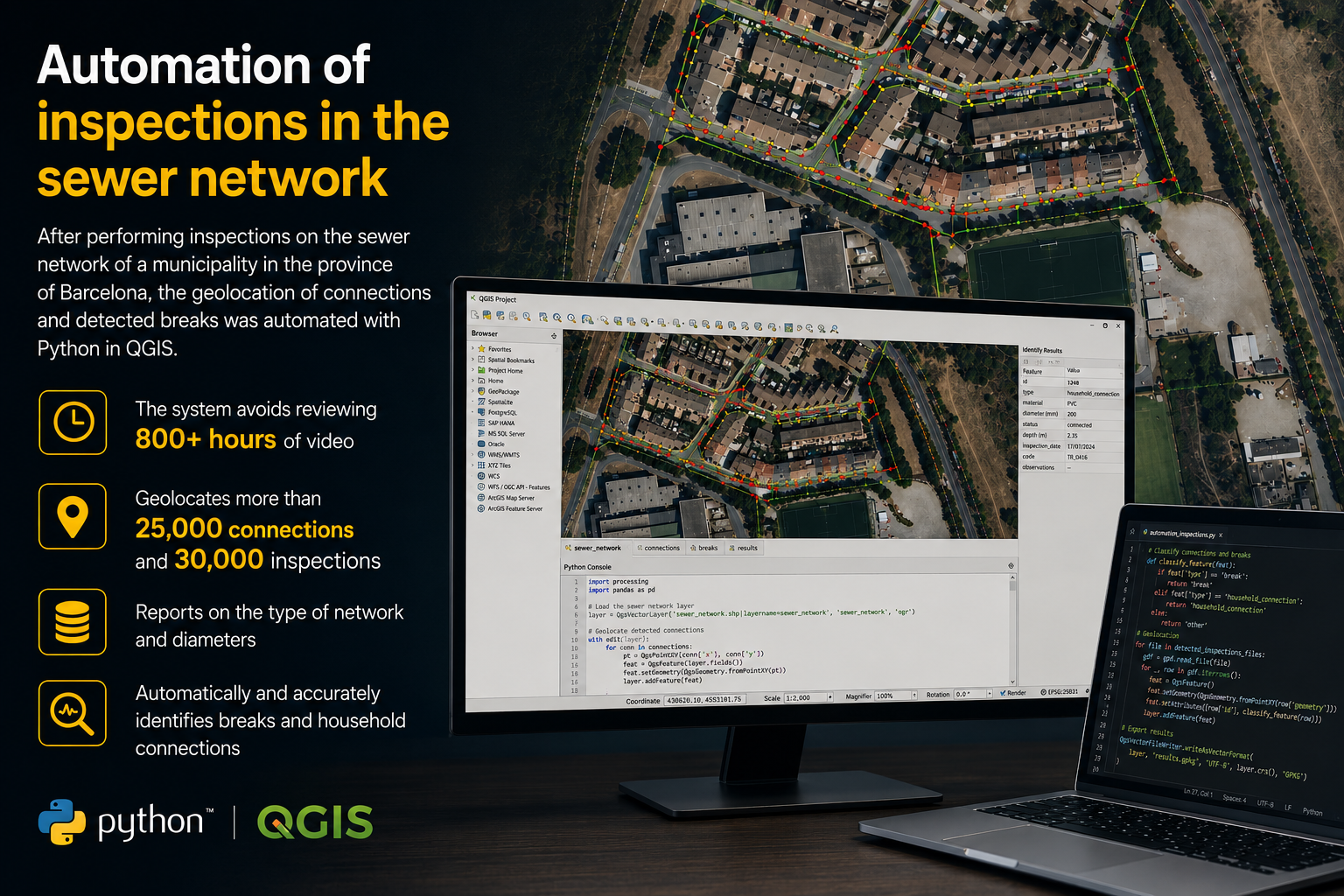
After carrying out inspections on the sewer network of a municipality in the province of Barcelona, Python scripts in QGIS were used to automatically geolocate connections and breaks detected during inspections. The system avoids reviewing over 400 hours of video, reports the network type and diameters, and identifies pipe failures and household connections automatically.
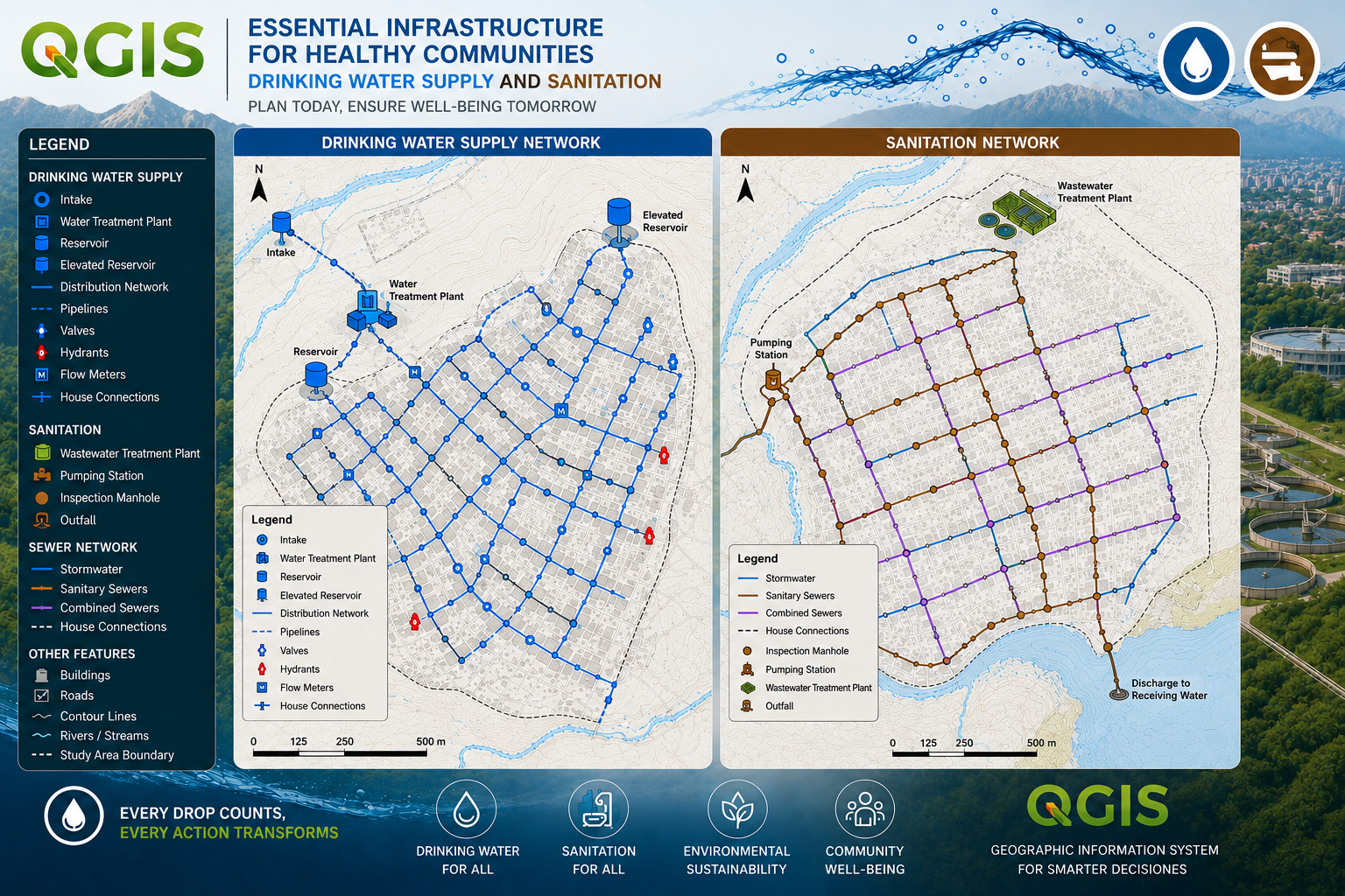
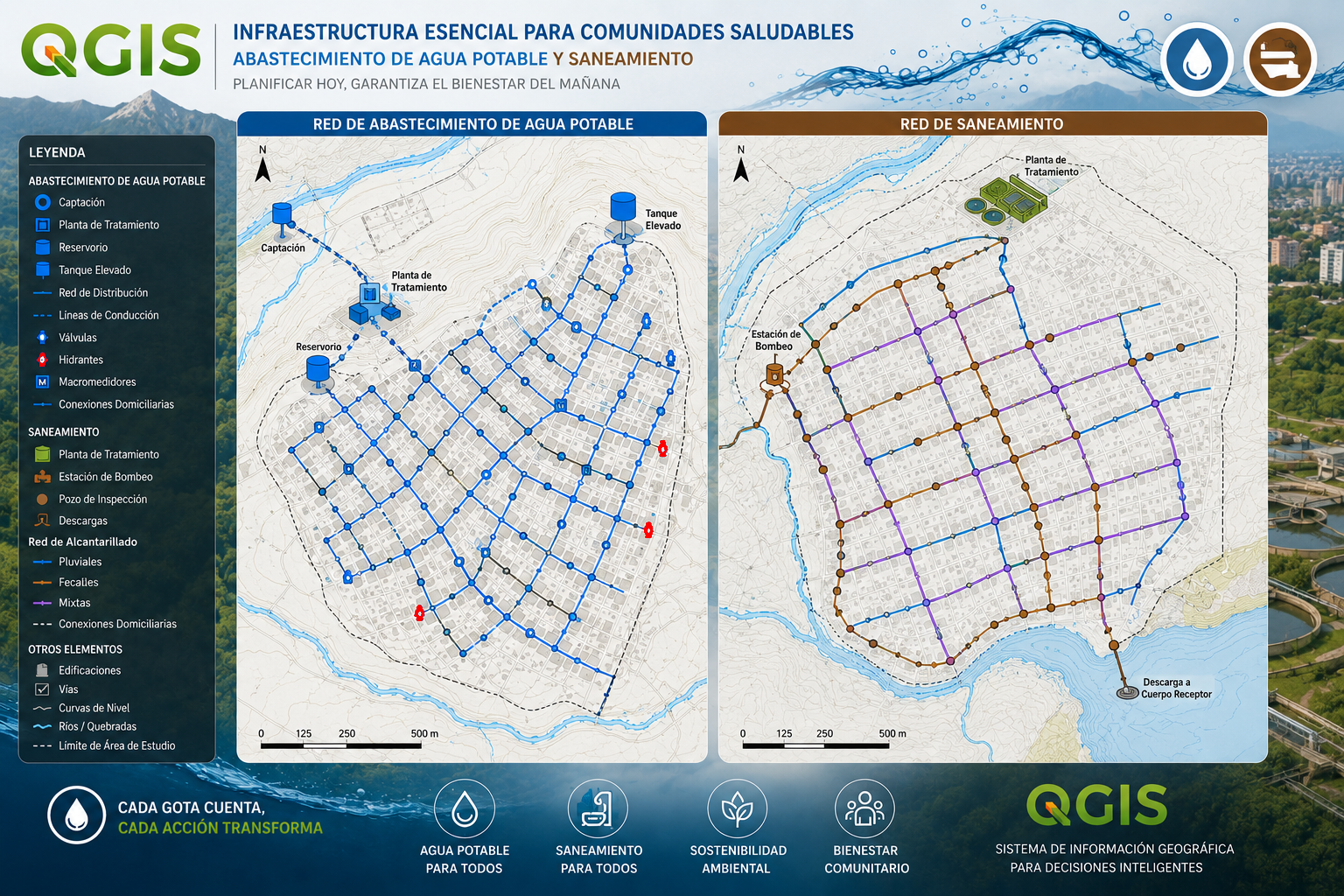
GIS inventory and digitalisation of water supply and sewerage networks. Survey and georeferencing of pipes, sewers, valves, hydrants, manholes, service connections and tanks, with their technical attributes (material, diameter, pressure, condition). The entire network is structured into a queryable spatial database, with cartographic viewers to plan maintenance, detect incidents and optimise water management. From the paper map to the digital twin of the network.
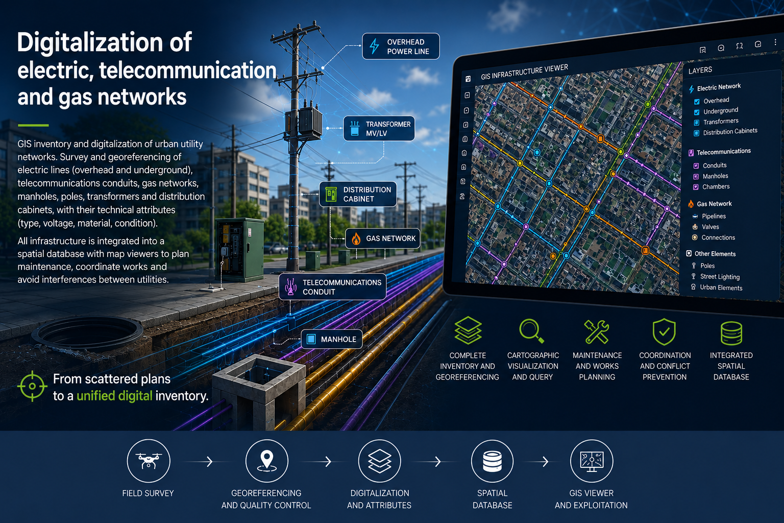
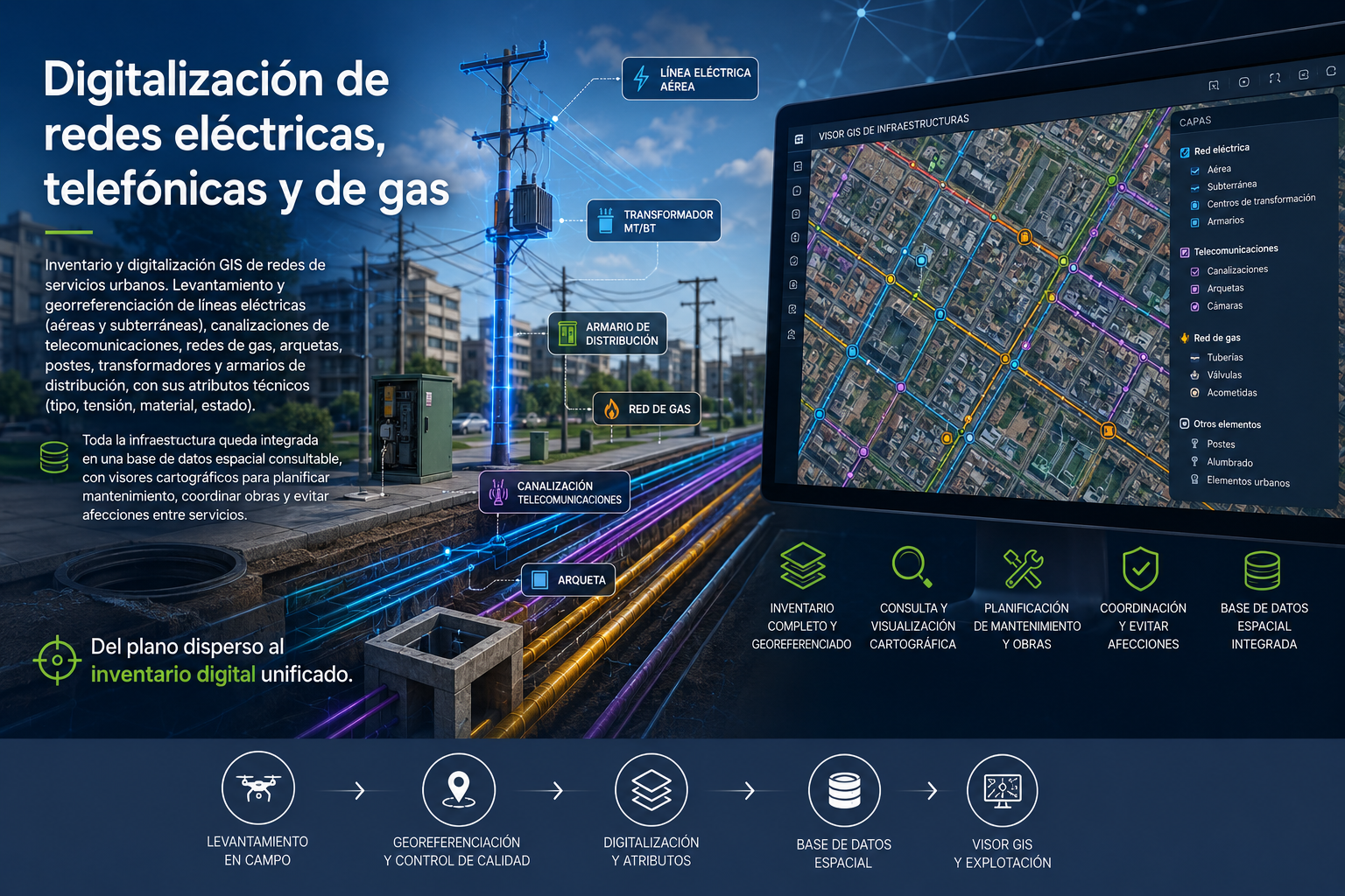
GIS inventory and digitalisation of urban utility networks. Survey and georeferencing of power lines (overhead and underground), telecom ducts, gas networks, manholes, poles, transformers and distribution cabinets, with their technical attributes (type, voltage, material, condition). The whole infrastructure is integrated into a queryable spatial database, with cartographic viewers to plan maintenance, coordinate works and avoid clashes between utilities. From scattered plans to a unified digital inventory.
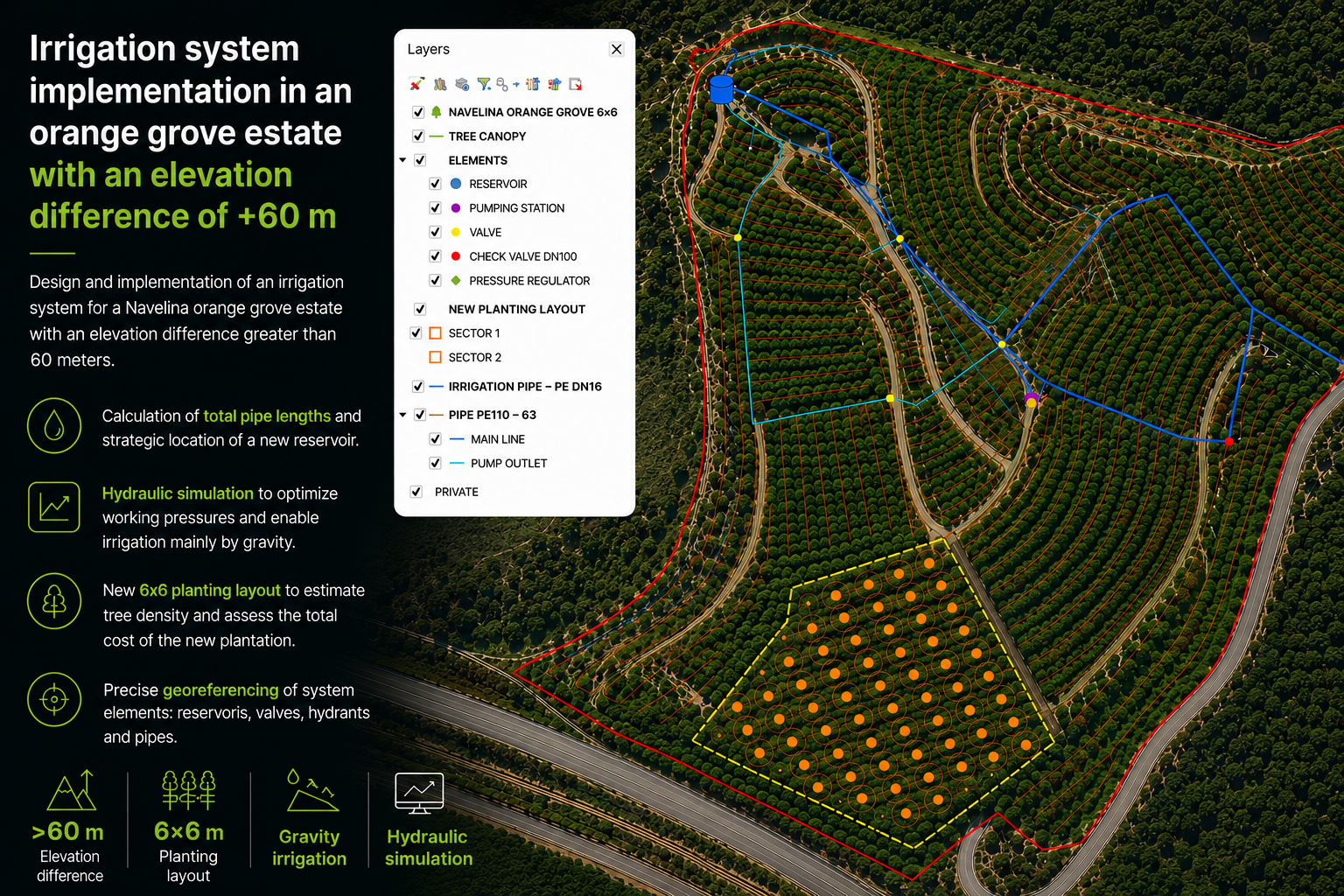
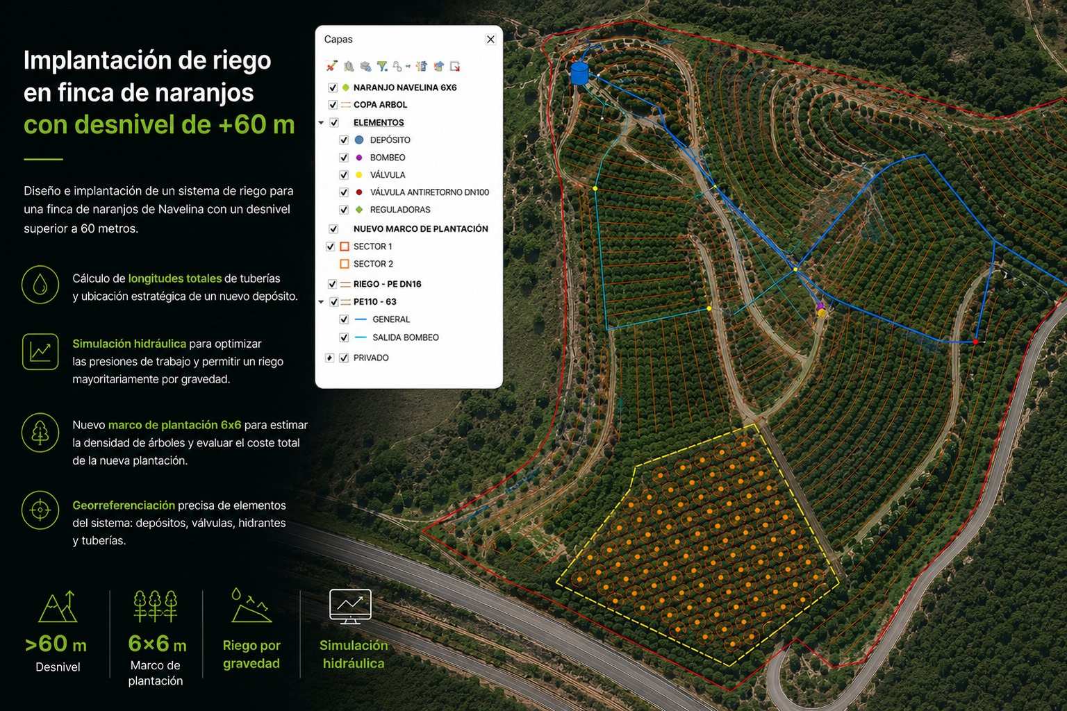
Design and implementation of an irrigation system on a Navelina orange grove with over 60 metres of elevation difference. Total pipe lengths were calculated, a new tank was located and a hydraulic simulation was carried out to correctly adjust pressures, optimising costs by irrigating mainly by gravity. A 6×6 planting grid was defined to estimate tree count and total plantation cost.

Launch of a web platform and mobile app available on the App Store and Google Play, designed for football referees looking to improve their technical knowledge and prepare for official exams. The platform includes tests based on real recent exam questions, personalised progress stats and a methodology focused on moving up the ranks. Improving as a referee has never been easier.

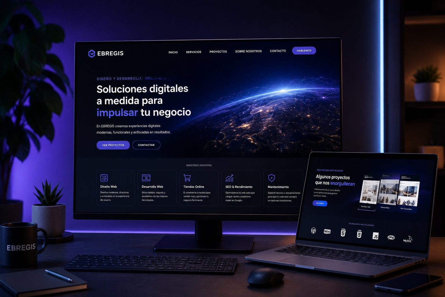
Design, development and deployment of professional custom websites for businesses and freelancers. From information architecture to production launch: corporate websites, conversion-optimised landing pages, portfolios and online shops. Modern technology, responsive design, optimised performance and SEO positioning from day one. Your business deserves a digital presence that delivers real results.
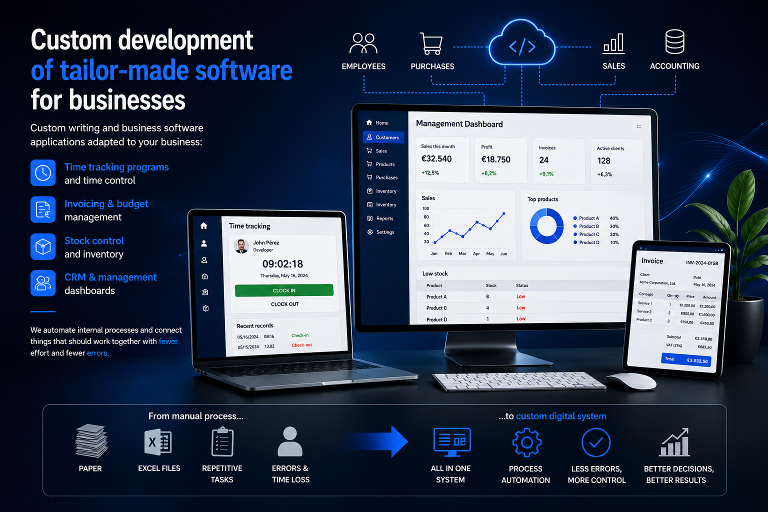
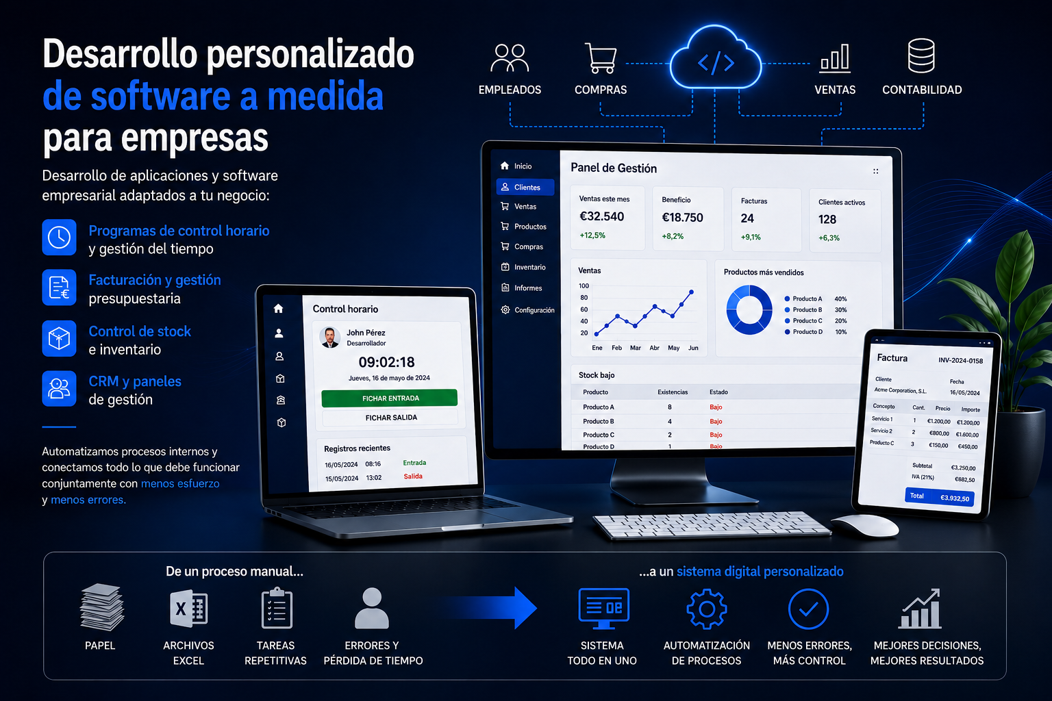
Custom desktop applications and business software tailored to your company: time-tracking and attendance systems, invoicing and quote management, stock and inventory control, CRM and management dashboards. We automate internal processes and connect your tools so you work with less effort and fewer errors. From the manual process to a tailored digital system.
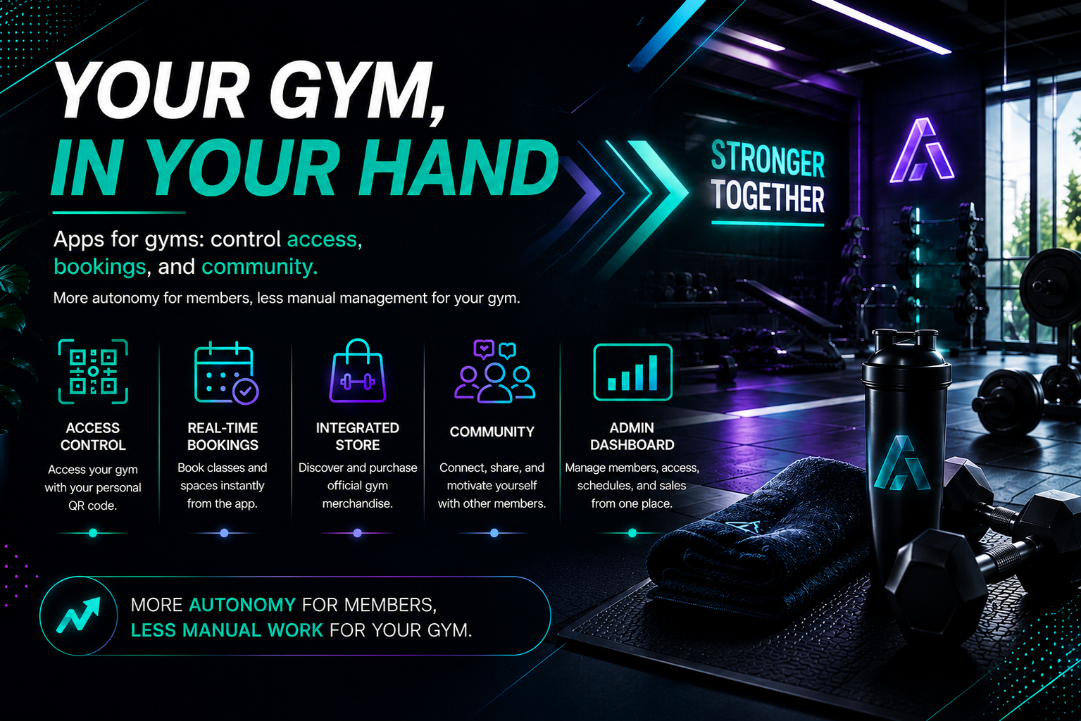
All-in-one mobile app for gyms and sports centres. Access control via personal QR code, real-time booking of classes and spaces, integrated merchandising store, access and activity calendar, and a social forum where members interact and share their progress. The admin panel manages members, capacity, schedules and sales from a single place. More autonomy for members, less manual work for the gym.

Complete mobile app for driving schools that digitises the entire student experience. From the app, students can check their progress and pending lessons, make class bookings independently and buy lesson packages directly from their phone. The admin panel lets the school manage the calendar, students and payments in real time. Fewer calls, less paperwork, more business.

Complete platform to digitalise your barbershop management and boost your revenue. Clients book online 24/7, choosing service, date and time in seconds, with automatic reminders via WhatsApp and email to reduce no-shows. The admin panel centralises the agenda, barbers, schedules and services in real time, accessible from any device. Fewer calls, fewer cancellations and a more professional experience for your clients.
We are currently working with public administrations, but for confidentiality reasons we cannot show these projects until they are completed.
Automated inspections · Sewer network · QGIS + Python · Barcelona
Dual-frequency GNSS receivers simultaneously tracking GPS, GLONASS, Galileo and BeiDou. RTK differential correction in real time with centimetre precision.
Real-time precision via NTRIP network or own base. Horizontal ±2cm, vertical ±2cm.
GPS L1/L2 + GLONASS + Galileo + BeiDou. Better availability and PDOP in any scenario.
Scientific processing, per-point precision report and closure check on all survey work.
Interactive cartographic viewers developed with QGIS and qgis2web. Leaflet, OpenLayers and MapLibre with vector and raster layers and WMS/WFS services in real time.
Example project: This viewer shows a GIS analysis aimed at locating the optimal site for a sports resort in the Tarragonès region, combining criteria of accessibility, population, topography and land use.
Technical rigour, automation and complete documentation in every project.
Requirements definition, review of existing data and design of the technical solution.
Field work with high-precision instrumentation. Processing, quality control and validation.
GIS implementation, Python automation and publication of standard geospatial services.
Complete technical documentation, user training and scheduled post-project maintenance.
We seek technology professionals: apps, web, GIS and surveying. Real projects, a committed team and a high-level technical environment.
Send CVGPS/GNSS surveys, total station, precision levelling and technical support for civil engineering projects.
Cadastre, boundary demarcation, cadastre-registry coordination and boundary file processing.
iOS, Android and React Native developers with experience in technical sector apps, booking systems and e-commerce.
Frontend, backend and full-stack. Corporate websites, portals, e-commerce and custom digital platforms.
QGIS, ArcGIS, PostGIS and automation with GeoPandas, GDAL and Fiona. Advanced spatial analysis.
Tell us what you need. We reply within 24 hours with a tailored proposal.
In compliance with applicable law: Company name: EBREGIS, S.L. · Tax ID (NIF): B26708800 · Registered office: C/ Benicarló, 41, 43897 Tortosa (Tarragona), Spain · Registry: Commercial Registry of Tarragona, IRUS 1000466740058 · Activity: Technical engineering services and other activities related to technical consultancy. Technical architecture services · Email: info@ebregis.com · Scope: Spain and international.
Governs access, navigation and use of the EBREGIS website. Access implies full acceptance of these terms.
All content is the property of EBREGIS or authorised third parties, protected by Spanish and international law. Reproduction without express written authorisation is prohibited.
The user agrees to lawful use of the site. Fraudulent use or introduction of malicious code is prohibited.
EBREGIS does not guarantee continuous availability and is not liable for damages arising from unavailability.
Spanish law. Disputes shall be submitted to the courts of the user's domicile (if a consumer) or Spanish courts otherwise.
a) Contact form: Legal basis: consent (Art. 6.1.a GDPR) and pre-contractual measures (Art. 6.1.b GDPR).
b) Applications: Consent (Art. 6.1.a GDPR). Maximum retention: 12 months.
Maximum 5 years, after which data will be deleted or anonymised.
EBREGIS does not share data with third parties except when legally required. No transfers outside the EEA.
You may exercise rights of access, rectification, erasure, restriction, portability and objection by writing to info@ebregis.com.
You may lodge a complaint with the Spanish Data Protection Agency (AEPD).
Text files stored on the user's device by websites to ensure correct operation and obtain statistics.
Technical (exempt): cookie_consent (12 months), _ebregis_session (session).
Analytics: _ga / _gid — Google Analytics, up to 2 years.
Preferences: _ebregis_prefs — language and settings, 6 months.
Use the cookie management panel or your browser settings. Blocking all cookies may affect site functionality.