You've probably seen interactive maps where each point holds detailed information. Behind them is a technology that many companies and public bodies use every day to make better decisions. Here we explain, without jargon, what GIS is and how it can help your organisation.
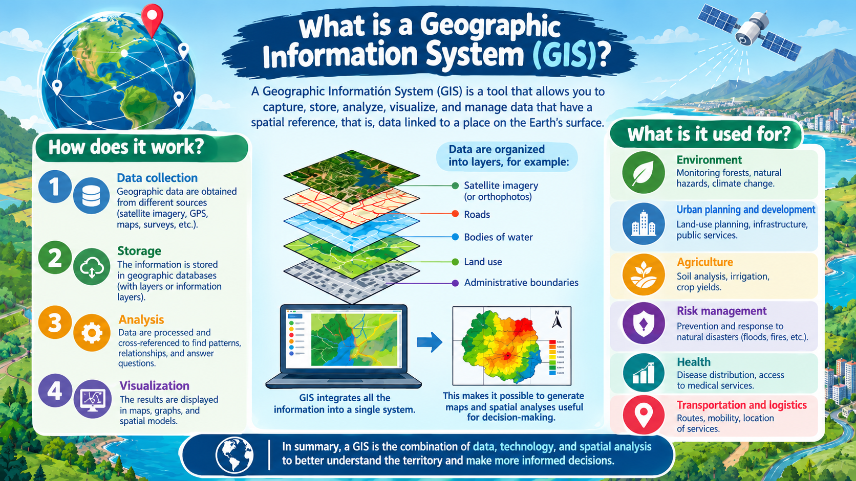
What GIS is
GIS stands for Geographic Information System. It is a system that lets you capture, store, analyse and visualise data tied to a location. Put simply: it connects information with the place it belongs to and lets you see it on a map.
The difference from an ordinary map is that GIS doesn't just show where something is, it cross-references layers of information to answer questions. It's not a photo of the territory: it's a database with geographic intelligence on top.
How it works
GIS organises reality into layers. One layer might be the water pipe network, another the cadastral plots, another the faults logged last year. Overlaying them reveals relationships invisible in a spreadsheet: for example, that faults cluster on one specific, older stretch of pipe.
Each element carries its own information: an electricity pole stores its installation date, condition and last maintenance. The map becomes a tool for querying and analysis, not just display.
What it's for in a company
Infrastructure and network management. Water, electricity, gas or telecoms companies know where each element is, its condition and when to act. It cuts response times and organises maintenance.
Location-based decisions. Where to open a site, which areas to cover, how to optimise routes. When a decision has a geographic component, GIS provides data instead of guesses.
Managing distributed assets. Inventory and manage any element spread across the territory on a single map.
Compliance and documentation. Well-ordered geographic information makes audits and regulatory requirements easier.
What a map viewer is
The interactive map on screen is called a map viewer: the «window» through which people in the company consult the GIS information without being technical. A good custom viewer shows exactly what each team needs.
Does your company need GIS?
If you work with information that has a location (networks, assets, plots, routes, incidents) and manage it today in spreadsheets or loose plans, GIS is very likely to save you time. You don't need to start with a large system: you can begin by digitising one network or building a first viewer. At EBREGIS we build custom GIS systems, digitise infrastructure and create map viewers tailored to each organisation.